



Galveston Bay Habitat Project DatabaseExplore all GBEP-funded NRU projects from 2005 to present by location, watershed, species, organization, goals, and funding.
North American Breeding Bird SurveyInvestigate and download North American Breeding Bird Survey data by year, species group, and survey route using interactive charts.
Coastal Creel Survey - Fisheries HarvestInvestigate and download the total individual species caught by year and fishing activity group using an interactive chart.
Habitat - Ecological Mapping SystemsExplore dominate habitats aggregated from the Ecological Mapping Systems database by watershed.
Social Vulnerability IndexExplore and visualize the Social Vulnerability Index across 4 themes by county and census tract.
Water, Sediment, and Tissue QualityExplore and download reported values of water quality and field parameters collected from sediment, water, and historical tissue (1974 - 2012) data by parameter, year, watershed or subbay.
Trinity-San Jacinto Estuary Freshwater InflowsInvestigate and download estimated freshwater inflows to the Trinity-San Jacinto Estuary (Galveston Bay) by year.
Seafood Consumption AdvisoriesView map of TDSHS seafood consumption advisories for freshwater and saltwater species.
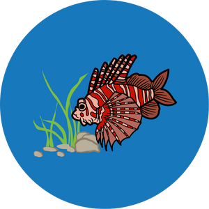
Non-Indigenous Aquatic SpeciesExplore observations of nonindigenous or invasive aquatic species by watershed and species.
Land and Impervious CoverExplore and download historical (2001 and 2006) and current (2016) land use/land cover and urban percent imperviousness data by watershed.
Impervious Cover (2019)View a map of the most recent (2019) USGS National Land Cover Database percent impervious cover.
Groundwater Well, Quality, and LevelExplore and download groundwater well water quality and level data by year and county.
Coastal Oil SpillsInvestigate and download coastal oil spill data (volume and count) by year, watershed or subbay.
Coastal Fisheries Resource (CPUE)Investigate and download the Catch Per Unit Effort (CPUE) data by year, gear type, selected species, and subbay using an interactive chart.
Coastal Commercial Fisheries LandingsInvestigate and download coastal commercial fisheries harvest data for the value ($) and weight (lb) of harvested species by year and waterbody using interactive charts.
Total Datasets43
Have questions or suggestions? Provide comments through the Feedback Submission Tool.
Featured
Galveston Bay Habitat Project Database
Explore all 58 GBEP-funded NRU projects from 2005 to present.